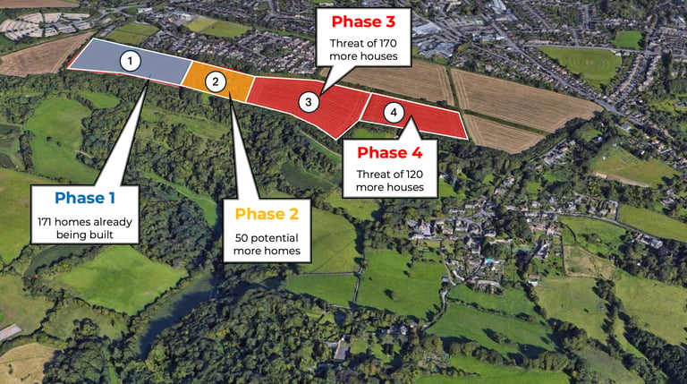
The Hignett Family Trust and Welbeck Land have applied to build ‘up to 200’ more houses on the South Stoke plateau.
The full proposal is available to view on the B&NES website here. The key document is the Design and Access Statement, which can be viewed here. SoBA has provided guidance notes for objectors, which are available here. See also the notes below.
The consultation period is has now closed. Over 800 objections have been submitted and thank you to everyone who has submitted.
If you haven't written an objection yet and would like to, you can still email it in the next few days to development_management@bathnes.gov.uk with reference number 26/01238/EOUT in the subject line.
SoBA has provided guidance notes for objectors, which are available here. See also the notes below.
SOBA have submitted a detailed objection to the proposal which can be seen here.
What happens next?
B&NES will have to go through all the information that has been submitted and may ask for some amendments and/or more information from the developers. Depending on the level of change, there could be another period of consultation, as there was last time.
We don’t yet know when the application will go to the B&NES Planning Committee.
To receive regular updates from SOBA join our mailing list here.
The Planning Inspector has set out why HFT’s previous application was rejected — the new application still falls far short in addressing these issues...
When the Planning Inspector dismissed the Hignett Family Trust's appeal in March 2025, he set out three main reasons for his decision: the impact on the Cotswold National Landscape, the impact on heritage assets and the extent of mixed use.
The negative impact on the Cotswold National Landscape was the decisive factor and was given the most weight by the Inspector. The entire site lies within the Cotswold National Landscape (CNL), which was formerly known as the Cotswold Area of Outstanding Natural Beauty. The Inspector stressed the landscape value of the plateau and its contribution to the CNL’s special qualities. He was critical of the current phase 1 development and concluded that the Phases 3 and 4 then proposed would have too great a visual impact from within the CNL.
The other two areas where he considered there would be a negative impact were the impact on heritage assets and the extent to which the development was, or was not, mixed use.
SOBA remains strongly opposed to the latest application for ‘up to 200’ more houses. It remains a significant over-development and does not adequately address the issues that the Inspector identified.
The Current Application must be rejected for numerous reasons including:
Too many houses overall — still far above "around 300" The Local Plan allows "around 300" houses across the whole plateau allocation. This application proposes ‘up to 200’ more houses on top of the 171 already built in Phase 1. Add in the likely Sulis Manor Phase 2 development (up to 50 units) and the proposed Odd Down Football Club housing (18 units) and the total rises to well over 400. The developers' own documents only quote the 371 figure — conveniently omitting the rest. This is not a marginal difference. It is a fundamental breach of the Local Plan.
Southern screening — the decisive issue, still not resolved The Inspector's primary reason for refusal was that housing would be "clearly visible" from within the Cotswolds National Landscape in long-distance views from the south, and ‘it is unlikely that any amount of suitable planting would be sufficient to visually screen the housing during the day or night.’ As a result ‘It would not avoid a detrimental impact on the CNL.’
In the current proposal the built development extends too far to the south and is almost identical to the previous rejected application. The revised plans show only 5m of additional planting along most of the southern boundary. This is insufficient to screen the development from both near and long-distance views.
The maximum building heights for the current proposal will be the same as for the Phase 1. The Inspector criticised the ‘prominent and conspicuous location on the skyline’ of Phase 1, and questioned whether it met the local and national planning policy requirements to ‘avoid or minimise detrimental impacts’.
The developers have therefore not addressed the main reasons the previous application was rejected.
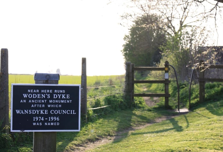
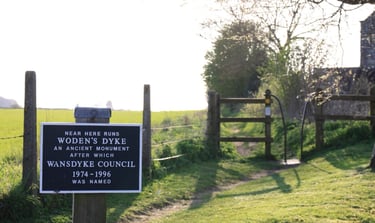
Eastern boundary — not addressed The eastern side of the development will be clearly visible to anyone joining the Wansdyke path at the Cross Keys junction and therefore adversely affects this Scheduled Ancient Monument. This is one of the key heritage assets that the Inspector identified as being affected. A belt of woodland should be planted on the eastern boundary to shield the views from the north-eastern side of the plateau.
Only ‘scattered planting’ is proposed along the eastern boundary. This is wholly inadequate.
No comprehensive masterplan — quite simply, the application should not proceed without one The Local Plan is unambiguous: a comprehensive masterplan, agreed with the Council, is a prerequisite for development across this allocation. The developers have not provided one. Phase 2 at Sulis Manor — up to 50 further homes on the same plateau — remains completely undefined. The masterplan is the only mechanism for assessing the true cumulative impact of everything being built here. Without it, the Council is being asked to approve one piece of a jigsaw while the rest remains hidden. That is precisely the piecemeal development the masterplan requirement was designed to prevent.
This application does not meet a basic condition of the Local Plan. That alone should be grounds for refusal.
Affordable housing mix — Phase 1's failures not corrected Phase 1 delivered twice as many one-bedroom flats as specified by B&NES at the expense of larger family homes. The new application commits to 40% affordable housing in principle but says nothing about remedying this existing shortfall in larger homes. B&NES must insist on the correct mix this time and not leave this matter to be resolved at a later date.
At SoBA, we remain opposed to over development and the latest application is still a long way from meeting key criteria as defined by the Planning Inspector who refused the HFT appeal last year.
Our position is clear: we will oppose any application that does not fully meet the requirements of the Planning Inspectorate and the Council's adopted Local Plan. Reducing the number of houses from 290 to 200 is not enough on its own. The scheme must resolve all the reasons the previous application was refused — and this one does not.
The consultation closes on 30 May 2026. Please make your voice heard.
You can submit your comments to B&NES directly here →. Please use your own words — even a short comment counts. The key points you may wish to raise are:
The total dwelling count across the whole plateau will exceed 400, far above the Local Plan's "around 300"
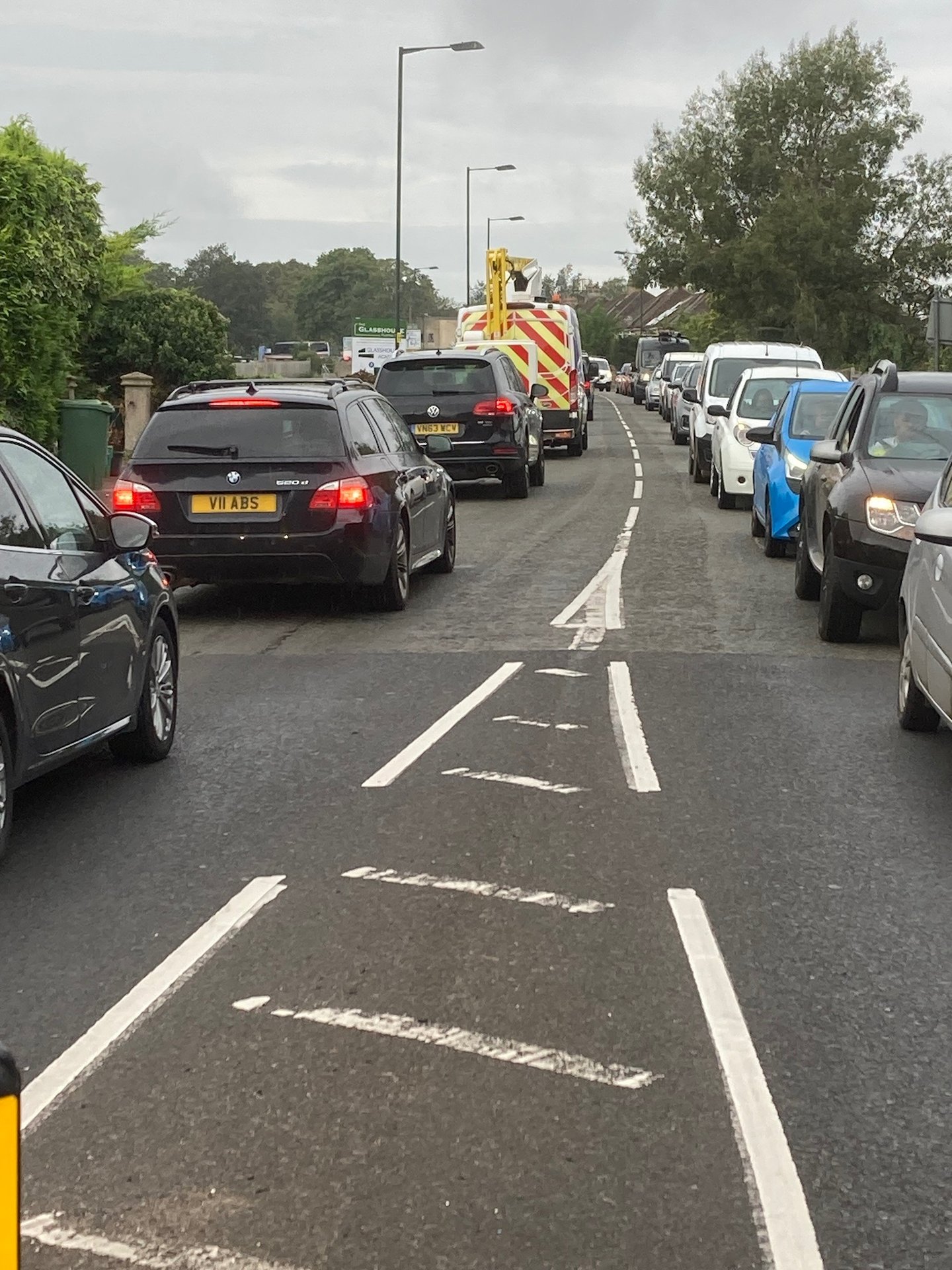
An excessive number of houses in Phases 3 and 4 will increase the pressure on local infrastructure (e.g. the road network, local schools, doctor’s surgeries) and the environment.
The southern screening proposed is insufficient to protect long-distance views within the Cotswolds National Landscape
The eastern boundary has inadequate planting and will remain visually exposed
There is no complete comprehensive masterplan for the whole allocation
The affordable housing mix from Phase 1 must be corrected, not repeated
It is not expected that the Inspector will make his decision known until several weeks after the end of the Inquiry.
Attending the Inquiry
We are not planning a protest before the meeting as that would be inappropriate on this occasion. If you wish to attend the Inquiry in person then please e-mail planning_appeals@bathnes.gov.uk with your name and why you are interested in attending. The Inquiry will also be live streamed and can be watched here.
As was the case at both Planning Committee meetings, it is important that attendees are respectful and listen to all the arguments without interruption.
Speakers at the Inquiry
There is the opportunity to speak at the Inquiry, as there was at the Planning Committee. Given the level of interest, the Planning Inspector has asked us to coordinate with other objectors to avoid repetition but also to ensure that the local community’s views are represented. SOBA, the Parish and the Ward Councillors will endeavour to do this.
If you have any queries, please contact us at info@soba.org.uk .